
I loved drawing maps as a child. Fantasy lands, I’d sketch them out on scraps of paper.
The fascination started in the 70s with wall posters of Middle Earth, Earthsea, Narnia, etc. But I wanted my own worlds eventually scraping out a rough corner of Ansu in the 1990s––most sketches happened while hauling steel in the East End of London, in dark nasty alleys and rain-dreary depots. Since then I’ve been lucky enough to have some fabulous maps drawn by renown artists & cartographers like Roger & Linda Garland and Francesca Baerald who recently created the Ansu World Map. Most feature below with an introduction and explanation of each. JWW.
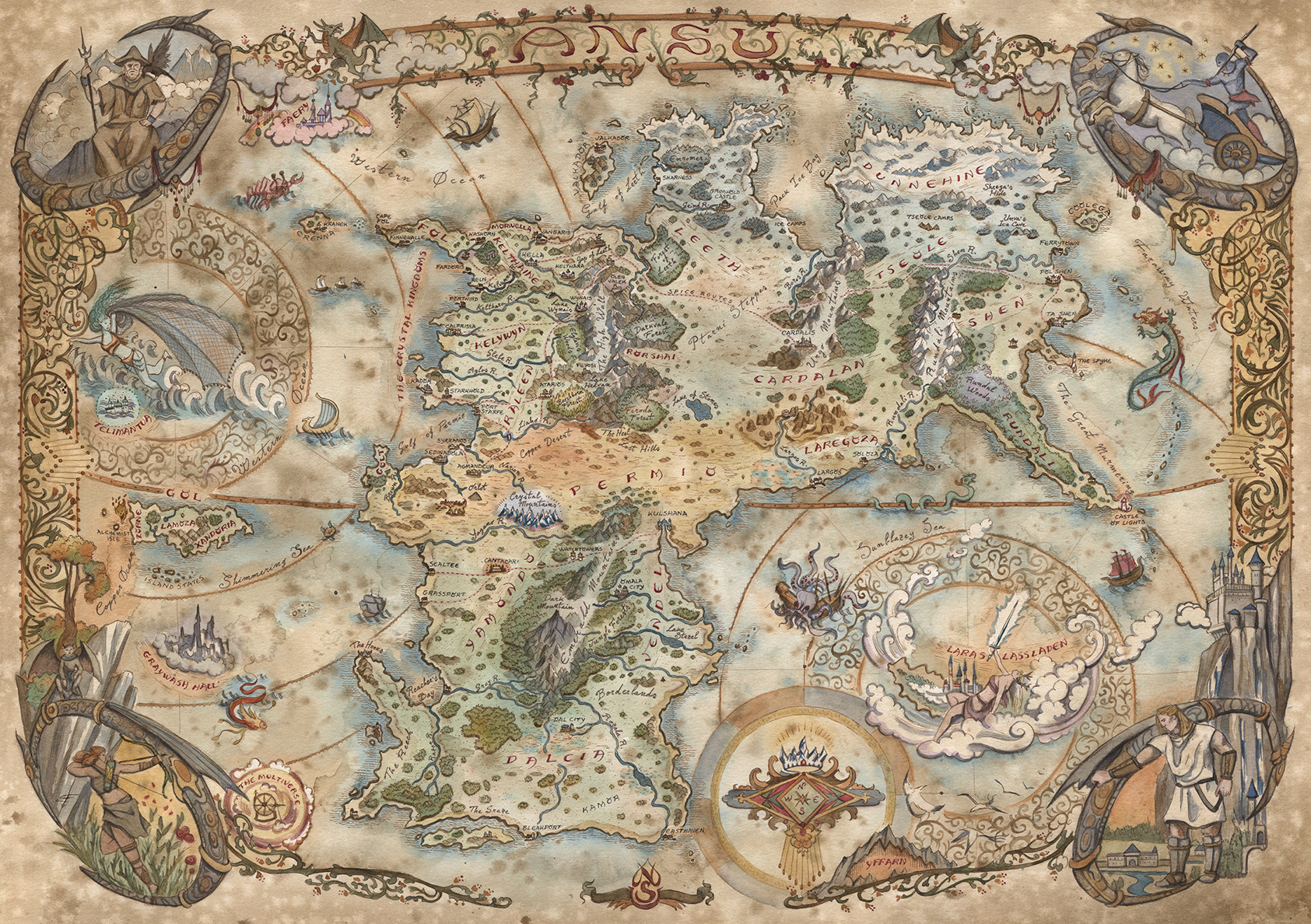
World Map
Francesca Baerald
Francesca Baerald is a fabulous artist and cartographer from Italy whose works include world maps for Middle Earth from The Lord of the Rings and Westeros, Game of Thrones and Warhammer to name a few. I approached Francesca with the idea of a map that not only showed the lands and oceans in context, but shared the myth and magic with gateways into the other realms like Laras Lassladen and Graywash Hall. The map includes several of Ansu’s otherworldly beings and four of the High Gods: The Wanderer, The Sky God, The Hunter, Old Night guard at the corners.

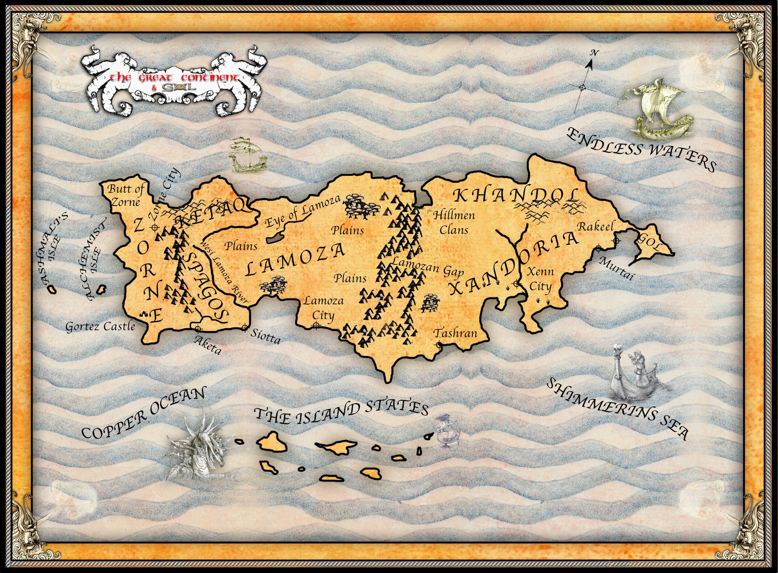
Great Continent
Roger Garland
This large island included the lands of Zorne, Xandoria and Gol from the Dawn of Legends period. Named the ‘Great Continent’ by Zorne’s earliest rulers––In those days the mainland was a wilderness filled with otherworldly beings. Apart from colonies along the coast, The Great Continent was the only place settled by humans. Much of its landmass got destroyed in the ruinous floods that sank Gol. Only the Island States and small parts of Xandoria survived that disaster.
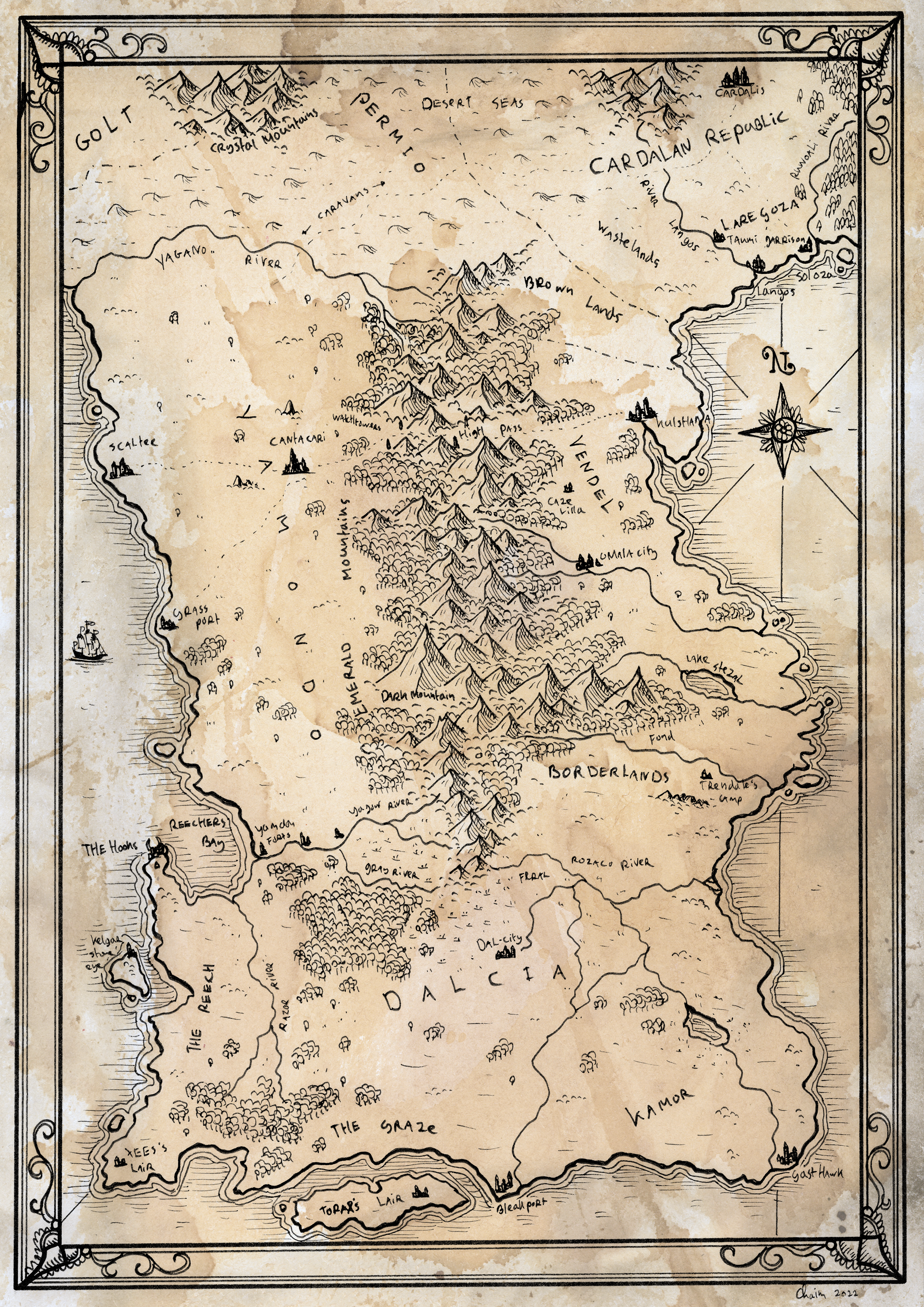
Southern Ansu
Chaim Holtjer
Cartographers of Ansu knew Yamondo and Vendel. It was much later that Dalcia appeared on the map. The remote, bleak southern land featured in the book Dreamslayers. There’s little known of its history, but the Aralais wizard folk had a stronghold at the Hooks on the Reech. A sinister place avoided by sailors. Further north and much warmer, Yamondo and Vendel were age long enemies. Dark Mountain lies amongst the jungles of southern Yamondo. A region of terror where Old Night’s severed head got incarcerated deep within its catacombs at the end of the Second War of the Gods.
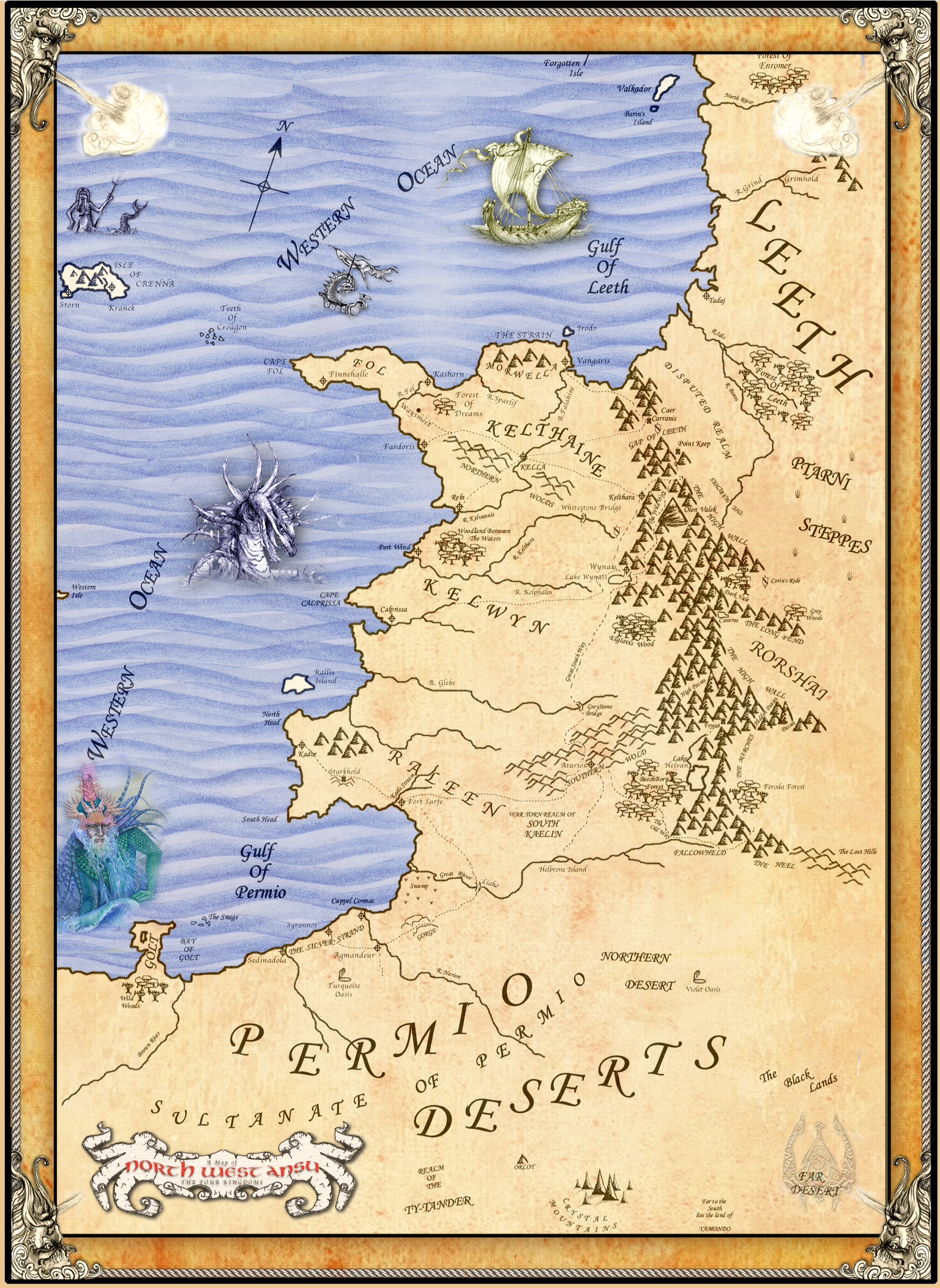
Northwest Ansu
Roger Garland
I sketched the original map with a bic biro on a truck receipt around 2001. Roger kindly took over years later, and this became the first Ansu map. Back then, we only knew about the Four (Crystal) Kingdoms and Pirate Isle, Crenna, and barbarous Leeth. The lands mentioned in the first books: (The Shattered Crown) And Permio (The Lost Prince.)
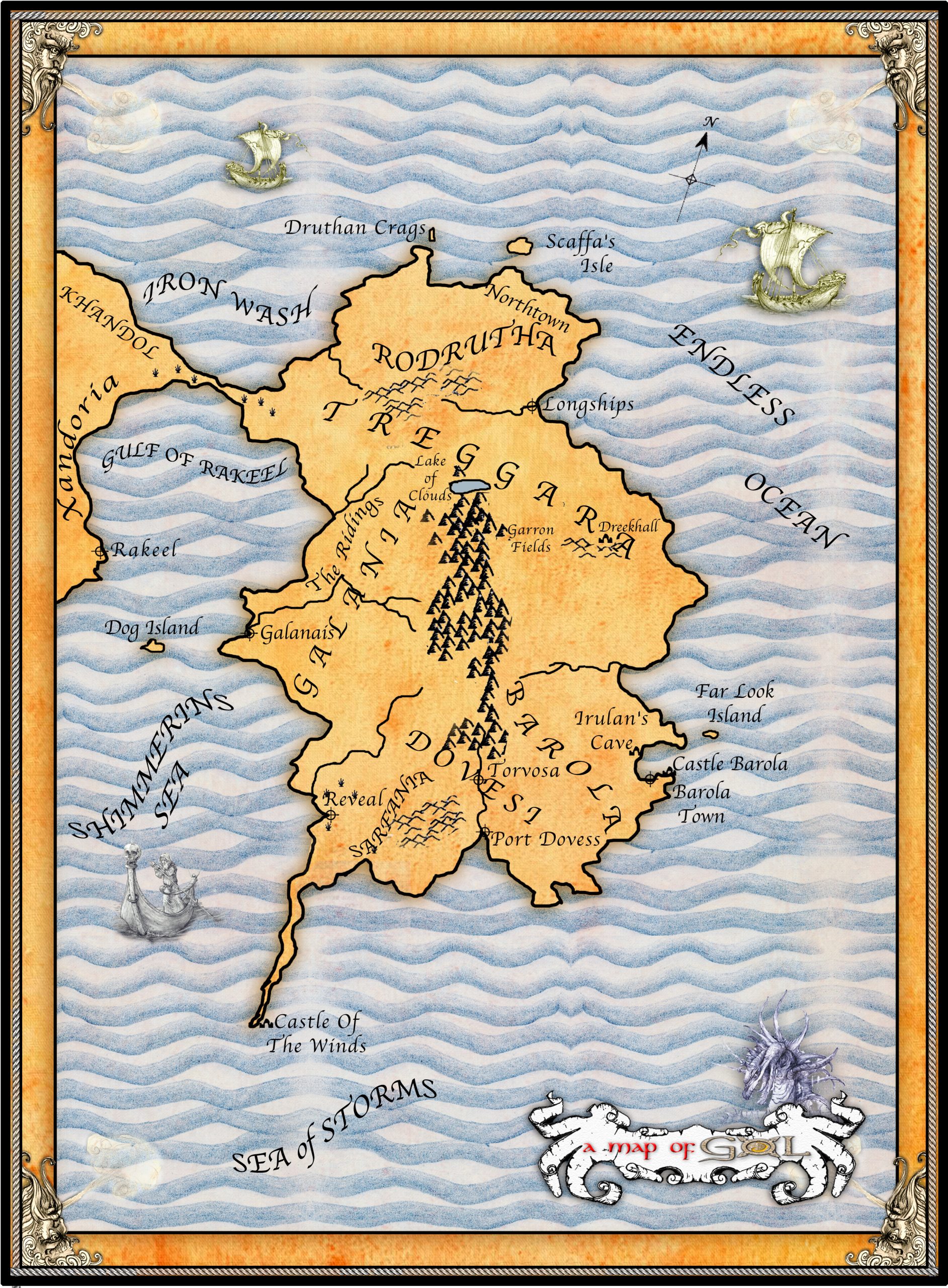
Gol
Roger Garland
This map shows the six provinces of Gol: Galania, Rodrutha, Treggara, Barola, Dovesi and Sarfania. Originally occupied by the Elementals––spirit relatives of the Faen peoples. Settled by Casmadian, the Conqueror, who became the first king of Gol. The last king, Flaminius III, got deposed by Barons in the Rebellion, an event which indirectly led to the destruction of the continent years later. The great libraries in Galanais and Torvosa got destroyed in the flood and little remained of those ancient archives, including those stolen from the Citadel of Zorne.
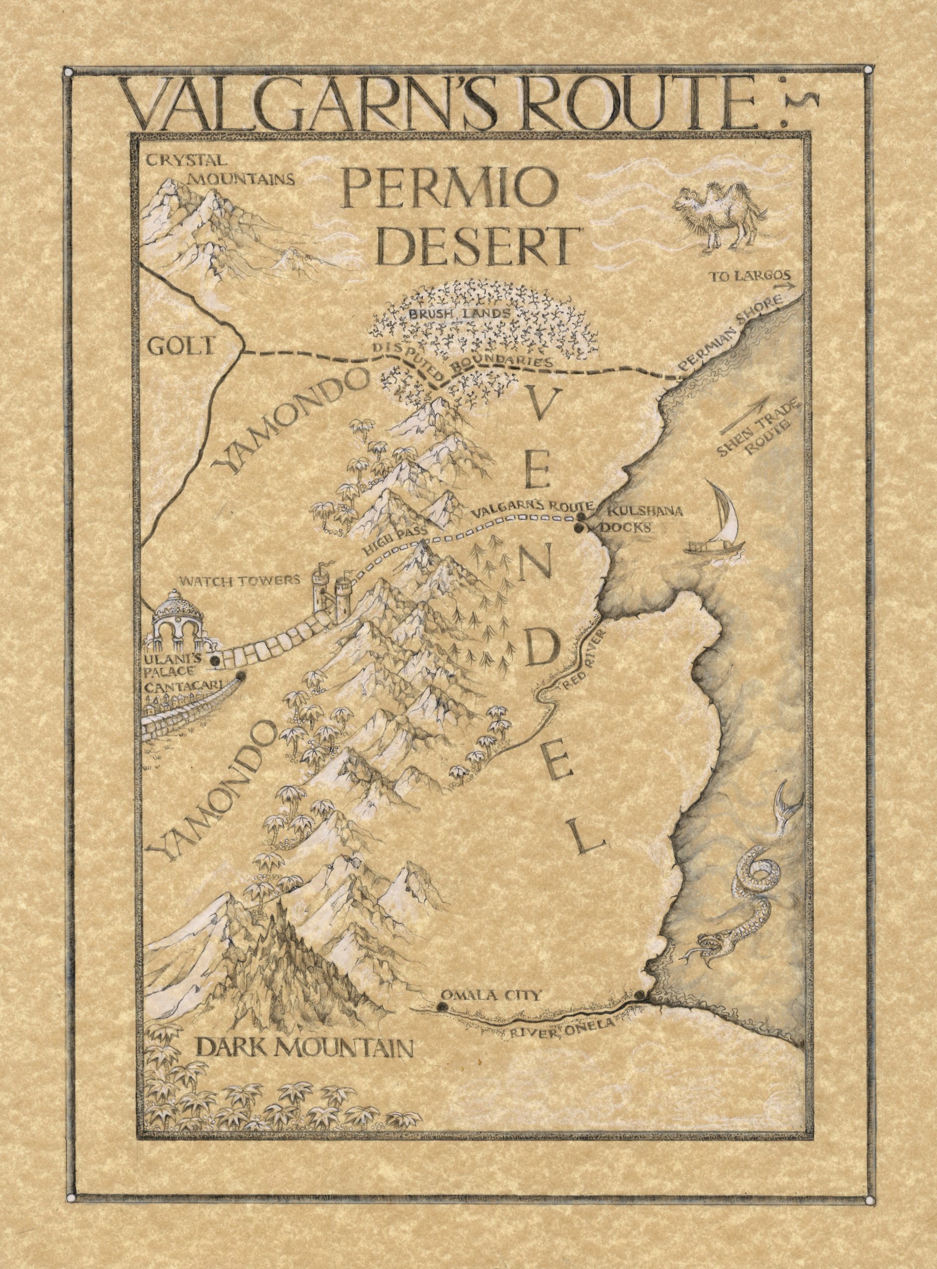
Valgarn’s Route
Linda Garland
From the Berserker Trilogy. Shows the journey made by the Northman Valgarn and his leman Trisa from Laregoza through hostile Vendel to Cantacari during the Shen/Cardalan War.
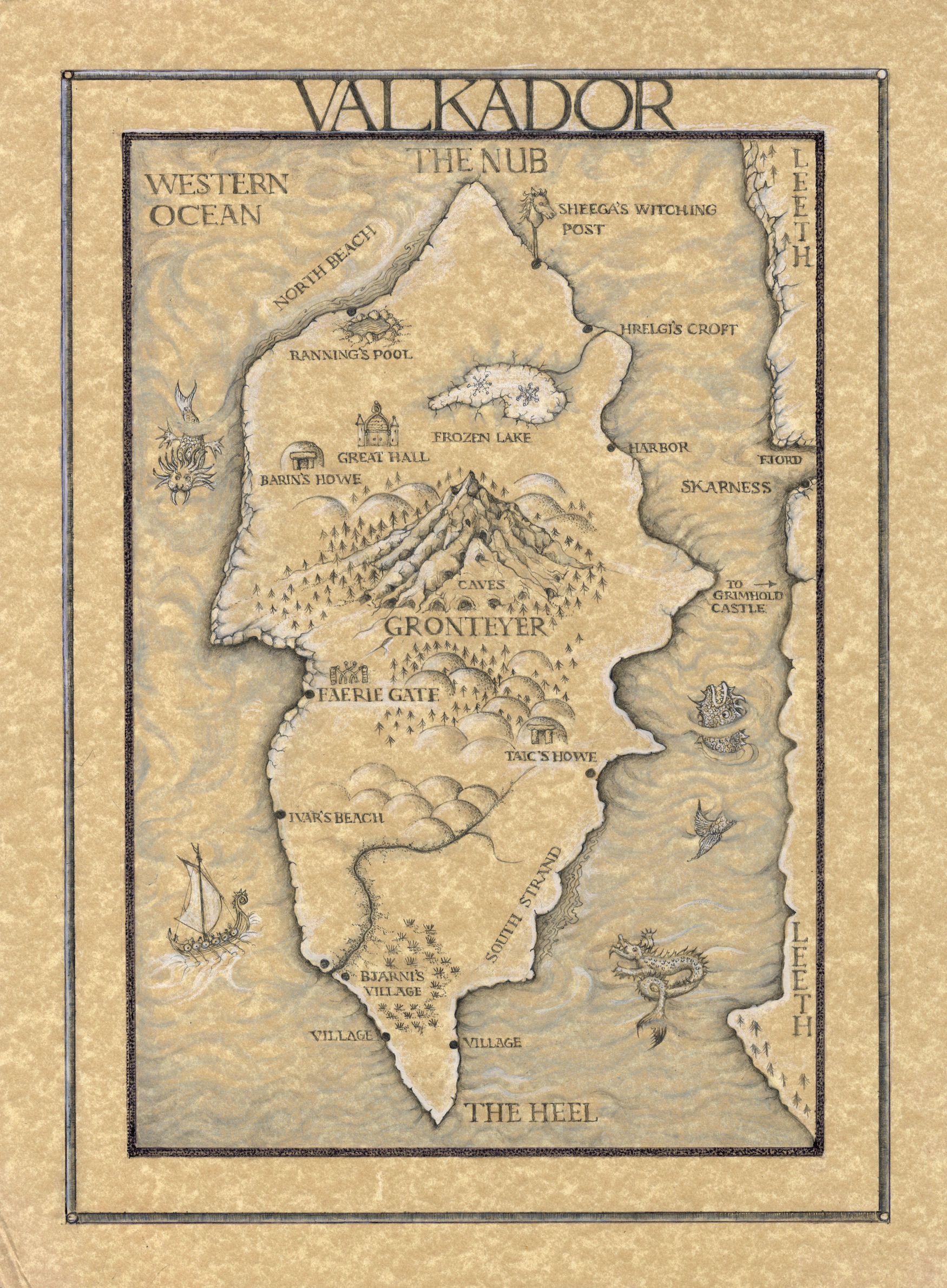
Valkador
Linda Garland
A map of Barin’s island that also features in the Berserker Trilogy, the home of the Ice Witch Sheega. And exile Jaran Saerk. Valkador was once part of the kingdom of Leeth, but broke away in rebellion and formed an independent state, ruled by Jarles. The Northmen of Valkador were renowned mariners.
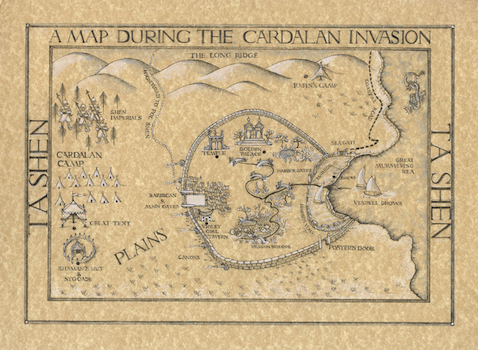
Ta Shen
Linda Garland
Linda’s map of Shen’s second city shows the siege occurring during the end of the war between Shen and Cardalan. Ta Shen’s well known for its gardens and benign climate. Also, a great trading port where Laregozan and Vendeli sailors often traded their goods. Much of the city got destroyed during the siege, which culminated in both the death of the empress, Rasnei, and the defeat of the Cardalan invaders.


